
MONROE — Severe weather including high winds Friday, July 11 dumped enough rain in parts of Southwest Wisconsin to change the year’s rainfall totals from below average to above average.
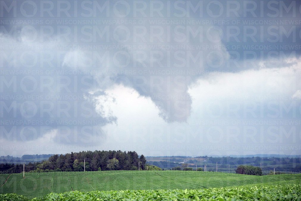
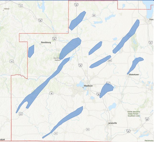
Tornado warnings blanketed the area from west of Dubuque, Iowa, to Shullsburg, Monroe and Janesville. Then on Wednesday, July 16, supercells and funnel clouds emerged again.
Rainfall reports included 7.08 inches north of Darlington, 6.04 inches in Dickeyville, 3.14 inches at the Platteville Municipal Airport, 2.67 inches north-northwest of Darlington, 2.34 inches south of Blanchardville, 2.33 inches north-northwest of Burton, 2.25 inches in Benton, 2.04 inches southwest of Dodgeville, 1.9 inches east of Blanchardville, 1.84 inches south-southeast of Darlington, and 1.8 inches in Eastman.
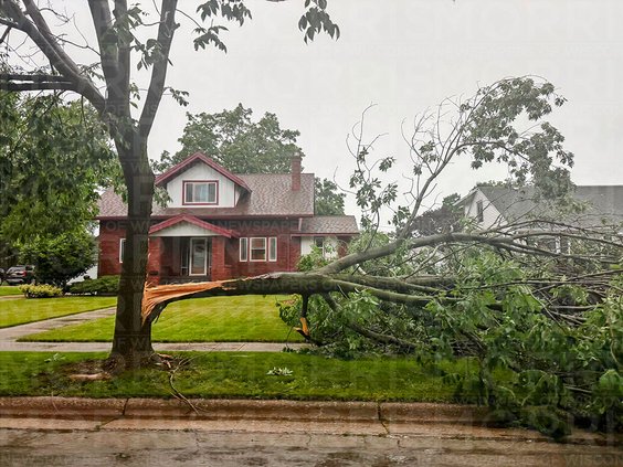
Winds of 79 mph were reported east-northeast of Monroe and north of Scales Mound, 74 mph north-northeast of Monroe, 71 mph south of New Glarus, 70 mph in Hazel Green, 65 mph in Potosi, 62 mph south-southeast of Belmont, and 60 mph four miles north of Tennyson. Tree damage was reported throughout Lafayette County, with corn flattened near Elk Grove.

Flash flooding was reported on Grant County H near Jamestown, McAdam Road in Paris, Morningview Road southwest of Lancaster, two miles north of Georgetown, Ingwell Road west-southwest of Blanchardville, Ferndale Road and Rollercoaster Road near the Pecatonica River. Up to 6 inches of water was reported over 100 yards of Wisconsin 191 near Dodgeville. Water was reported over the road on Porters Bridge Road in Beetown. Roads near Darlington and Calamine were closed.
Because of flooding, several Lafayette County Fair events in Darlington were postponed and rescheduled for this weekend. The races at the Lafayette County Speedway were moved to Friday. The Lafayette County Tractor Pullers tractor pull will be Saturday at 6:30 p.m. The monster truck show will be Sunday, with the pit party at noon and the show at 1:30 p.m.
The storms on July 16 caused more tornado warnings for southern Wisconsin. A tornado touched down near Dodgeville, while funnels were scene across Iowa, Lafayette, Green, Dane, Jefferson, Sauk, Columbia and Dodge counties.
— Steve Prestegard and Adam Krebs contributed to this report